Measurement of Agricultural Land: A Complete Step-by-Step Guide
Measuring agricultural land accurately is one of the most crucial aspects of modern farming, real estate transactions, and land management. Whether you are a farmer determining the right amount of seed and fertilizer, a landowner preparing for sale, or a government official verifying land records, accurate land measurement ensures fairness, efficiency, and productivity.
In this detailed guide, we will explore everything you need to know about the measurement of agricultural land — from traditional tools and manual methods to modern technologies like GPS and digital mapping. By the end, you’ll have a clear understanding of how to measure land precisely, interpret results, and use the information for practical agricultural and legal purposes.
1. Understanding Agricultural Land Measurement
Agricultural land measurement refers to the process of determining the exact area and boundaries of farmland. The measurement can be expressed in various units depending on the country or region.
Common units include:
- Acre: Widely used in the United States, the UK, and Pakistan (1 acre = 43,560 square feet).
- Hectare: A metric unit used internationally (1 hectare = 2.471 acres).
- Bigha, Kanal, Marla: Traditional units still common in South Asia.
- Square meter/square foot: Used in modern and official survey systems.
The goal of land measurement is to know the total area and exact boundaries, ensuring accurate records, effective resource planning, and prevention of land disputes.
2. Importance of Accurate Land Measurement in Agriculture
Accurate measurement plays a vital role in the success of agricultural operations. Here’s why it matters:
a. Crop Planning and Resource Allocation
The size of your land determines how much seed, water, fertilizer, and pesticide are needed. Overestimating or underestimating area can cause financial losses and poor yields.
b. Land Valuation and Sales
Property buyers and sellers rely on accurate measurements to assess fair value. Even a small error in land size can cause significant financial differences.
c. Legal Documentation
Land records, government registrations, and tax documents are based on exact measurements. An incorrect area can lead to legal disputes or loss of ownership rights.
d. Irrigation and Soil Management
Knowing the precise area helps in designing irrigation systems, dividing land into plots, and maintaining soil fertility evenly.
e. Government Schemes and Subsidies
Many agricultural subsidies and support programs depend on land area. Accurate data ensures fair eligibility and benefits for farmers.
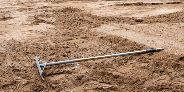
3. Traditional Methods of Measuring Agricultural Land
Before digital technology, farmers and surveyors relied on simple manual tools. These methods, though basic, are still used in rural areas due to their affordability and practicality.
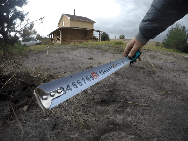
a. Chain and Tape Method
This is one of the oldest and most widely used manual methods.
Tools Needed:
- Measuring chain or long tape (usually 100 feet or 30 meters)
- Wooden or metal pegs
- Compass for direction
- Field notebook for recording measurements
Steps:
- Mark all boundary points of the land with pegs.
- Measure the distance between each point using the chain or tape.
- Record each side’s length in your notebook.
- Divide irregular land shapes into smaller triangles or rectangles.
- Use geometric formulas (length × width or Heron’s formula) to calculate the total area.
Advantages:
- Low cost and easy to perform.
- Suitable for small and medium-sized fields.
Disadvantages:
- Human error can occur due to uneven ground.
- Time-consuming for large or irregular plots.
4. Modern Techniques for Measuring Agricultural Land
Today, technology has transformed how land is measured. Modern tools provide faster, more accurate, and professional results with minimal manual effort.
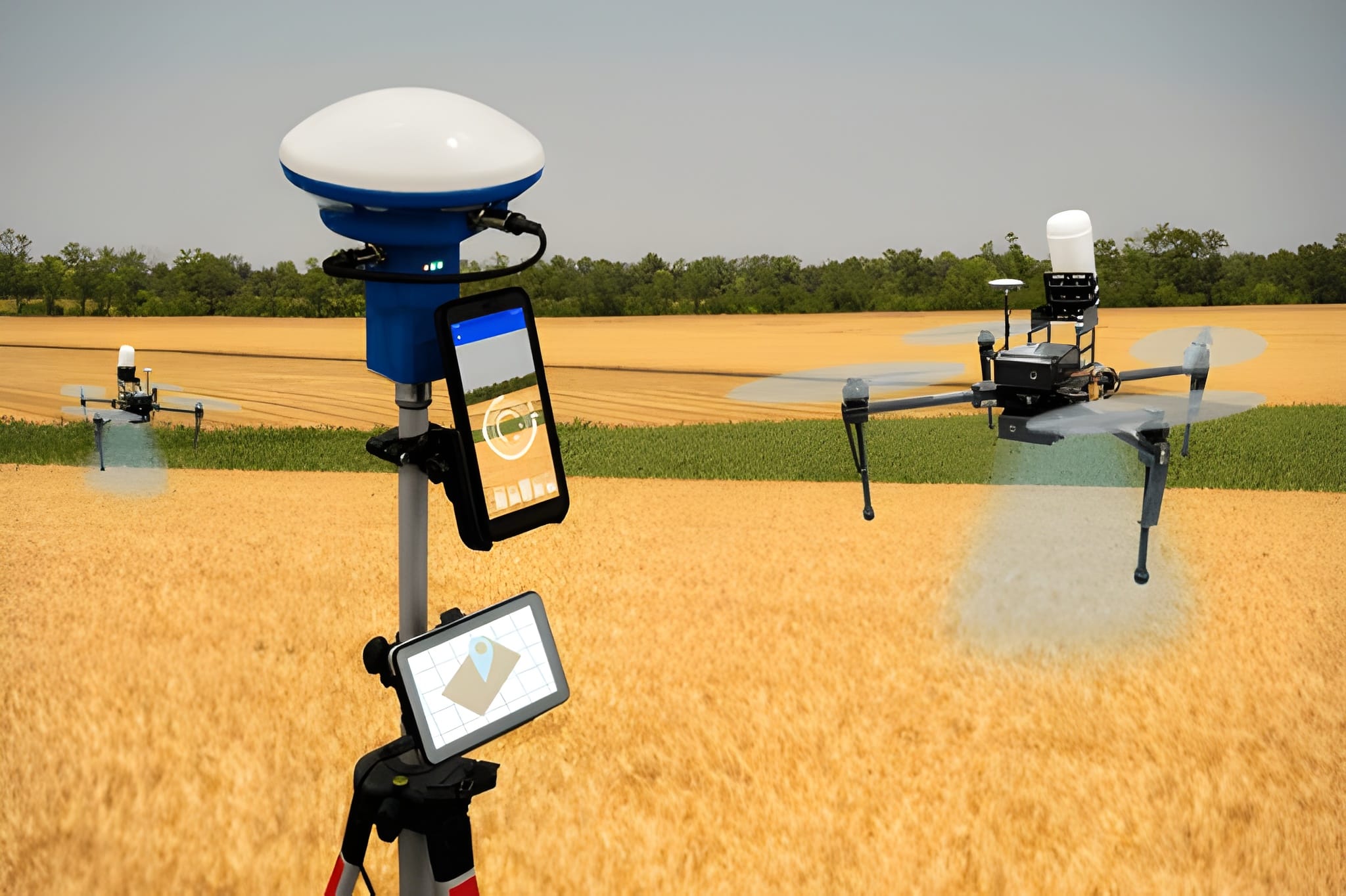
a. GPS (Global Positioning System) Devices
Handheld GPS units or mobile apps can record boundary coordinates and automatically calculate the total area.
How it Works:
- Walk around the boundary of your land with the GPS device.
- The device records latitude and longitude points.
- Once the loop is complete, the software calculates total land area.
Benefits:
- High accuracy (within a few centimeters for advanced systems).
- Ideal for large farms.
- Data can be stored or exported digitally.
Popular Tools: Garmin GPS, Trimble devices, or smartphone apps like GPS Fields Area Measure.
b. Total Station Survey
A Total Station is a professional electronic instrument combining the features of a theodolite and distance meter.
Key Features:
- Uses laser technology for distance measurement.
- Provides 3D data (angle, distance, and height).
- Commonly used for government surveys and construction.
Though expensive, it is highly accurate and suitable for large agricultural or commercial land assessments.
c. Drone or Aerial Survey
Drones are now widely used to measure farmland and monitor crop health.
How it Works:
- Drones equipped with cameras and GPS fly over the land.
- Software stitches aerial images into a map.
- Algorithms calculate land area automatically.
Advantages:
- Quick, detailed, and highly accurate.
- Ideal for monitoring large areas and crop health.
- Generates visual maps for analysis.
Disadvantages:
- Requires trained operators and legal permissions in some countries.
d. Satellite and GIS Mapping
Satellite imagery and Geographic Information System (GIS) software allow land measurement at a regional scale.
Uses:
- Government agricultural mapping.
- Large-scale land classification and management.
- Soil, vegetation, and irrigation planning.
Tools like Google Earth Pro also help individuals measure agricultural plots by marking boundary points on the satellite image.
5. How to Calculate Area for Different Land Shapes
Land isn’t always square or rectangular, especially in rural and hilly areas. Different shapes require different formulas for accurate measurement.
a. Rectangular or Square Plot
Formula:
Area = Length × Width
Example:
If a plot measures 200 feet by 150 feet,
Area = 200 × 150 = 30,000 sq. ft.
Convert to acres: 30,000 ÷ 43,560 = 0.688 acres
b. Triangular Plot
Formula:
Area = ½ × Base × Height
Example:
Base = 100 feet, Height = 60 feet
Area = ½ × 100 × 60 = 3,000 sq. ft.
c. Irregular Plot (Uneven Boundaries)
For irregular shapes, divide the plot into smaller triangles or rectangles, measure each part, and add the results together.
You can also use Heron’s Formula if all sides are known:
Area = √[s(s–a)(s–b)(s–c)]
where s = (a+b+c)/2 and a, b, c are the sides.
6. Using Online Tools and Apps
With smartphones and the internet, measuring agricultural land has become much easier. Several free and paid tools can calculate area instantly.
Popular Online Tools:
- Google Earth Pro – Mark boundary points and view accurate area in acres, hectares, or sq. meters.
- DaftLogic Area Calculator – Online map-based tool for fast estimates.
- GPS Fields Area Measure App (Android/iOS) – Ideal for farmers to measure plots in the field.
- Landmeasure.space – A simple and user-friendly web tool for land measurement worldwide.
These tools not only save time but also reduce human error and allow you to share results digitally with authorities or buyers.
7. Tips for Accurate Agricultural Land Measurement
- Use Calibrated Tools: Make sure measuring tapes or GPS devices are properly calibrated.
- Avoid Slope Error: Measure along the horizontal line, not the slope, for correct area.
- Check Boundaries Carefully: Confirm that all corner points belong to your property.
- Repeat Measurements: Take readings twice or thrice to minimize error.
- Record Data Properly: Maintain a written or digital log of all measurements and coordinates.
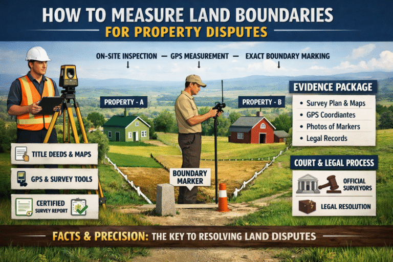
8. Legal and Government Land Surveys
In many countries, agricultural land must be officially surveyed by licensed authorities. A government survey ensures:
- Official records in land registry.
- Dispute resolution through legal documentation.
- Proper taxation and ownership verification.
The process typically involves:
- Requesting a survey from local land authorities.
- Site inspection by professional surveyors.
- Marking official boundaries using GPS or total station.
- Issuing a land measurement report or map.
9. Challenges in Measuring Agricultural Land
Despite advanced tools, challenges still exist:
- Irregular land shapes: Difficult to calculate manually.
- Obstacles and vegetation: Trees, fences, or uneven ground can affect accuracy.
- Access restrictions: Legal or physical barriers in boundary areas.
- Technical knowledge: Digital tools require training or guidance.
Overcoming these challenges requires combining technology with professional expertise.
10. Future of Land Measurement in Agriculture
The future of agricultural land measurement lies in precision farming and digital mapping. Emerging technologies like AI, drones, and satellite imagery are helping farmers make data-driven decisions.
Key Trends:
- AI-powered mapping: Automated land boundary detection.
- Blockchain-based land records: Secure and tamper-proof documentation.
- Smartphone integration: Easy access for farmers without costly equipment.
- IoT sensors: Integration with GPS and soil data for precision agriculture.
Conclusion
The measurement of agricultural land is not just a technical activity — it is the foundation for fair trade, effective farming, and sustainable development. From the simple chain-and-tape method to advanced GPS and drone surveys, today’s tools make land measurement more accurate and accessible than ever before.
Whether you’re measuring a small farm or a vast agricultural estate, understanding your land’s area helps you plan better, save resources, and increase productivity. By combining traditional knowledge with modern technology, farmers and landowners can ensure both accuracy and efficiency in managing their most valuable asset — the land itself.
✅ Key Takeaways:
- Always verify units (acre, hectare, bigha, etc.) based on local standards.
- Use modern tools like GPS and Google Earth for precision.
- Maintain accurate records for legal, financial, and agricultural benefits.
- Hire professional surveyors for large or disputed lands.
Image Credit: Shutter Stocks