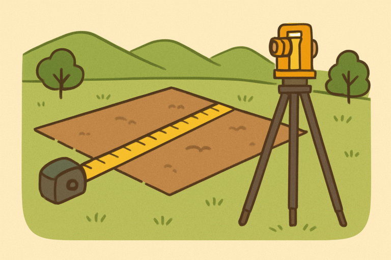
How Is Elevation of Land Measured? – A Complete Expert Guide
Understanding how land elevation is measured is essential for surveyors, civil engineers, GIS specialists, hydrologists, and planners. Whether you are mapping terrain, planning construction, or analyzing drainage systems, accurate elevation measurement forms the foundation of reliable data and smart decision-making.This article explains every detail — from basic principles to modern technologies — covering all major methods, tools, procedures, and real-world applications.
What Is Land Elevation?
Elevation refers to the vertical distance of a point on the Earth’s surface relative to a reference level — most commonly, the mean sea level (MSL).
It defines how high or low a point lies compared to this reference plane. Elevation data is crucial for mapping (topography), construction planning, flood risk analysis, water flow design, mining, and agriculture.
Core Terminology
Elevation vs. Altitude
- Elevation: Height of a point on the Earth’s surface above mean sea level.
- Altitude: Usually used for the height of aircraft or mountains above ground level.
Both terms describe vertical distance, but elevation specifically relates to land or terrain.
Reference Surface (Vertical Datum)
All elevation measurements are relative to a vertical datum, which defines the “zero level.”
Common examples include:
- Mean Sea Level (MSL) – Traditional reference for most land surveys.
- Geoid Models – Represent the Earth’s gravitational surface to which mean sea level conforms.
- Ellipsoidal Height – Used in GPS systems, relative to the mathematical model of Earth’s shape.
Principles of Elevation Measurement
Elevation is determined by finding the difference in height between a known benchmark (a reference point with known elevation) and a target point.
Mathematically: ElevationB=ElevationA+(Backsight−Foresight)Elevation_{B} = Elevation_{A} + (Backsight – Foresight)ElevationB=ElevationA+(Backsight−Foresight)
Vertical and Horizontal Control
- Horizontal control locates points accurately in the X-Y plane.
- Vertical control defines their Z (height) position.
Both are essential in geodetic surveying and construction.
Main Methods of Measuring Elevation
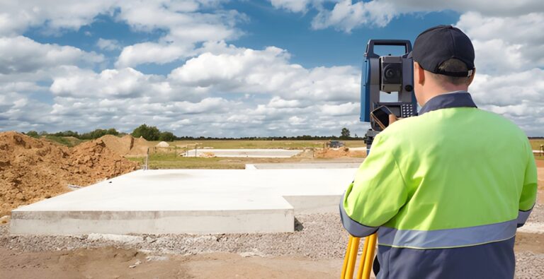
1. Direct Levelling (Spirit Levelling)
This is the most accurate and traditional method of measuring elevation.
Process
- Set up a levelling instrument (auto level, dumpy level, or digital level) on a tripod between two points.
- Take a backsight (BS) reading on a benchmark (known elevation).
- Take a foresight (FS) reading on the new point.
- Subtract FS from BS to find the difference in elevation.
Types of Levelling
- Differential Levelling: Determines the height difference between two points.
- Profile Levelling: Used for roads, canals, or pipelines to map elevations along a line.
Advantages
- Highly precise (error margin as low as ±2 mm per kilometer).
- Ideal for engineering, road design, and small-area surveys.
Limitations
- Requires line-of-sight visibility.
- Time-consuming for large or uneven terrain.
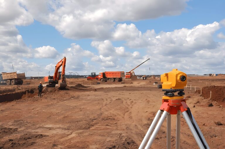
2. Indirect Levelling (Trigonometric Levelling)
Used when direct line-of-sight levelling is not possible — for example, across rivers or mountains.
Principle
Elevation difference is calculated using angles and distances: Height=Distance×tan(Vertical Angle)Height = Distance × \tan(\text{Vertical Angle})Height=Distance×tan(Vertical Angle)
Instruments Used
- Theodolite or Total Station
- Clinometer for simple angle measurement
Advantages
- Suitable for inaccessible terrain.
- Faster over long distances.
Limitations
- Affected by atmospheric refraction and instrument calibration errors.
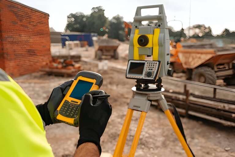
3. GPS / GNSS Elevation Measurement
Modern surveyors frequently use Global Navigation Satellite Systems (GNSS) such as GPS, GLONASS, or Galileo.
How It Works
- A GNSS receiver records signals from multiple satellites to determine a 3D position (latitude, longitude, and height).
- The Z-coordinate gives an ellipsoidal height, which is then converted to orthometric elevation (above mean sea level) using a geoid model.
Advantages
- Fast and wide coverage.
- No need for line-of-sight between points.
- Can integrate with GIS systems.
Limitations
- Vertical accuracy is lower than horizontal accuracy (±10 cm typical).
- Requires good satellite visibility and post-processing for best results.
4. LiDAR and Remote Sensing (Aerial Methods)
High-tech methods for large-area or high-resolution elevation mapping.
LiDAR (Light Detection and Ranging)
- Emits laser pulses from aircraft or drones.
- Measures the time taken for light to bounce back to determine surface elevation.
- Produces Digital Elevation Models (DEMs) and 3D terrain maps.
InSAR (Interferometric Synthetic Aperture Radar)
- Uses radar signals from satellites to detect ground elevation changes over time.
- Extremely useful for monitoring subsidence, landslides, and tectonic movement.
Advantages
- Covers huge areas quickly.
- Generates precise, high-resolution elevation data.
Limitations
- Expensive.
- Dense vegetation or water surfaces may distort results.
Step-by-Step Procedure for Measuring Elevation
Step 1: Identify a Benchmark
Choose a point with a known elevation — often established by national survey departments or geodetic databases.
Step 2: Calibrate Equipment
Check levels, tripods, and GNSS receivers for accuracy. Even small misalignments can introduce large errors.
Step 3: Take Readings
- Use BS and FS readings in levelling.
- Record angles and distances for trigonometric levelling.
- Or collect GNSS raw data for satellite-based methods.
Step 4: Compute Elevation
Apply formulas or use surveying software (like AutoCAD Civil 3D, Leica Geo Office, or Trimble Business Center) to process the results.
Step 5: Verify and Document
Cross-check using multiple methods.
Maintain detailed records of instrument setup, readings, and environmental conditions.
Sources of Error and Precautions
| Error Type | Cause | Prevention |
|---|---|---|
| Instrumental | Misalignment, incorrect calibration | Frequent calibration |
| Natural | Refraction, temperature, wind | Measure early morning or evening |
| Human | Reading mistakes, misidentifying benchmarks | Double-check logs |
| Datum Errors | Using wrong reference (ellipsoid vs. geoid) | Apply correct geoid model |
| GNSS Multipath | Reflected satellite signals | Use open areas, minimize obstructions |
Practical Use Cases
- Civil Engineering – Determining cut-and-fill quantities.
- Urban Development – Stormwater and drainage design.
- Agriculture – Planning irrigation slopes.
- Mining & Geology – Estimating depth and ore volumes.
- Disaster Management – Flood zone mapping and slope stability analysis.
Elevation Measurement in Pakistan
In Pakistan, elevation data is managed by Survey of Pakistan (SoP) using benchmarks across the country.
- GNSS-based control networks (like PaksiNet) now assist in precise vertical positioning.
- Engineers in hilly regions like Gilgit-Baltistan rely on trigonometric and GNSS methods, while plains (Punjab, Sindh) often use optical levelling.
For private land surveys, combining GNSS + auto level is considered both cost-effective and accurate.
Accurate Elevation Surveys by Land Measure
At Land Measure, we blend time-tested surveying techniques with the latest GPS, GNSS, and LiDAR technologies to provide precise and reliable elevation data for any terrain. Our expert surveyors ensure that every slope, contour, and elevation point is captured with exceptional detail. Whether you’re working on construction planning, real estate development, or environmental mapping, Land Measure delivers trusted, end-to-end elevation measurement services that bring accuracy and confidence to every project.
Conclusion
Measuring land elevation is a sophisticated blend of science, mathematics, and technology.
From simple spirit levelling to LiDAR-based satellite mapping, the goal remains the same: to accurately define the vertical position of the Earth’s surface.
Choosing the right technique depends on the terrain type, project budget, required precision, and available technology.
Accurate elevation data doesn’t just improve maps — it builds the foundation for safer construction, sustainable planning, and smarter development.
FAQs – Measuring Land Elevation
1. What is land elevation?
Land elevation is the vertical height of a point on the Earth’s surface above a reference level, usually the mean sea level (MSL).
2. Why is measuring land elevation important?
Elevation data helps in construction, drainage design, flood mapping, urban planning, road and bridge engineering, and environmental studies.
3. What are the main methods used to measure elevation?
Common methods include spirit levelling, trigonometric levelling, GPS/GNSS surveying, and advanced LiDAR or satellite-based measurements.
4. Which method gives the most accurate elevation results?
Spirit levelling is the most precise method, especially for engineering and small-scale surveys. For large areas, GNSS and LiDAR are preferred for efficiency.
5. How accurate is GPS for elevation measurement?
Standard GPS receivers have a vertical accuracy of about ±10 cm to ±1 m. High-end differential GNSS systems (RTK or PPP) can achieve accuracy within a few centimeters.
6. What is a benchmark in surveying?
A benchmark is a permanent reference point whose elevation is precisely known. It’s used as the base point for determining other elevations.
7. What tools are used to measure elevation?
Typical tools include a level and staff, total station, theodolite, GNSS receiver, clinometer, or LiDAR scanner depending on the method used.
8. How do LiDAR and satellites measure land elevation?
LiDAR sends laser pulses to the ground and measures the time taken for them to reflect back, while satellites use radar or laser altimetry to determine elevation.
9. What causes errors in elevation measurement?
Errors can result from instrument misalignment, atmospheric refraction, human reading mistakes, or incorrect reference datums.
10. How can elevation data be verified or corrected?
Surveyors compare data from multiple methods (e.g., levelling and GNSS) and apply geoid models to correct ellipsoidal heights to true sea-level elevations.
11. What is the difference between elevation and altitude?
Elevation refers to land height above mean sea level, while altitude is often used for aircraft height above ground or sea level.
12. Can elevation change over time?
Yes. Natural factors like erosion, earthquakes, subsidence, or sediment buildup can alter local elevation values over time.
Image Credit: Shutter Stocks