Essential Guide to Common Land Measurement Units
Imagine you’re standing at the edge of a vast plot of land—a blank canvas stretching before you. You hold a tape measure, a surveyor’s chain, or maybe just your smartphone. But what exactly does “one marla”, “one kanal”, “half an acre” or “one hectare” mean? How many square feet is that? What conversion should you use? In this guide, we plunge into the fascinating world of land measurement — its history, units, conversions, regional variations (especially in Pakistan), best practices, pitfalls, and the modern tools that make things easier. Whether you’re buying, selling or simply trying to make sense of your property, you’ll come away with a clear map in your mind.
1. Why Land Measurement Matters
Land is one of the most significant assets for individuals, families, businesses, and governments. Accurate measurement and clear understanding of how much land you are dealing with are critical for multiple reasons:
- Legal clarity: Property deeds, titles, tax assessments all rely on accurate measurement. A mis-measured plot may lead to disputes etc.
- Fair transaction value: If you don’t know exactly how many square feet, marlas or acres you are acquiring, you risk overpaying or under-selling.
- Planning & development: For construction, landscaping, agricultural use, you must know the size to plan cost, materials, layout.
- Comparison & conversion: Land markets often quote in multiple units — especially in areas like Pakistan where traditional (marla, kanal) and metric (square metres, hectares) coexist.
- Record-keeping and digital mapping: Modern cadastral systems, GIS, satellite imagery are all based on defined measurement units.
In short: without a good grasp of land measurement units and how they convert, you are flying blind.
2. Foundations of Land Measurement: Length, Area & Volume
Before diving into specific units, it’s helpful to recall two fundamentals:
- Length (linear measure) — how far (for example feet, metres, chains).
- Area — how much surface (for example square feet, square metres, acres). Land measurement is primarily about area.
- Volume may occasionally appear (e.g., for earthworks) but for land purchase, area dominates.
Because land is a two-dimensional concept (in terms of surface area), you’ll often see common formulas:
Area = Length × Width
When the shape is irregular, you may break it into regular shapes, or use surveyor tools, or digital GIS tools.
For length: common units include inches, feet, yards, metres. For area: square feet, square metres, square yards, acres, hectares, and region-specific units.
3. International/Common Units: Acre, Hectare, Square Metre, etc.
It helps to know the global or “common” units because many land deals, especially large ones, will reference them.
3.1 Acre
- According to one source: one acre = 43,560 square feet.
- In metric, an acre is approximately 0.405 hectares.
- Often used in countries with British or US measurement heritage.
3.2 Hectare
- One hectare = 10,000 square metres (a square of 100 m × 100 m).
- 1 hectare ≈ 2.471 acres.
- Common in metric-based land measurement systems (Europe, parts of Asia, agriculture).
3.3 Square metre and square feet
- Square metre (m²) is the base metric area unit.
- In terms of conversion: 1 sq ft ≈ 0.093 m².
- Square feet remains a widely used unit especially in regions influenced by imperial units.
3.4 Other older units (for completeness)
The website ‘Units of Measure – Land Measurements’ gives many less-common units: arpent, chain, engineer’s chain, pole/rod, rood, vara, etc.
While most of these won’t appear in everyday land transactions for many users, they’re worth knowing for historical context or for certain jurisdictions.
4. Land Measurement Units in Pakistan: The Traditional & Regional Picture
When you’re in Pakistan (which you are, Asad), you’ll encounter a mix of traditional units and metric/imperial ones — with regional variation. Let’s unpack the common ones, conversions, and the caveats.
4.1 Key units & their typical use
Here are the commonly used units in Pakistan, their approximate equivalents, and where they tend to apply:
| Unit | Typical equivalent | Common use / region |
|---|---|---|
| Karam | One linear “step” measured in feet (approx 5.5 ft or 1.67 m) | Rural/agricultural measurement, older systems |
| Square karam | (5.5 ft)² = 30.25 sq ft approx | Used in some regional measurement definitions |
| Marla | Approximately 272.25 sq ft or ~25.3 m² in many contexts. Note: In some regions (e.g., Lahore) 1 marla = 225 sq ft. | Urban/Residential plots in Punjab, Pakistan |
| Kanal | 20 marlas; roughly 5,445 sq ft or ~505 m² in typical listing. | Larger residential plots or small agricultural plots |
| Acre | In the Pakistan sense, often 8 kanals = 1 acre in some local usage. | For larger land-holdings |
| Begha / Bega | Defined in some regions: e.g., 1 bega = 4 kanals = ~21,779.2 sq ft (~2008 m²) in one conversion table. | Agricultural land in certain provinces |
| Murabba / Square | One murabba = 24 acres in one definition. | Large rural land parcels / revenue records |
| Bigha / Biswa | These are region-specific and vary widely; e.g., “1 acre = 4 bigha 16 biswa” according to one source. | Varies by province/region in Pakistan |
4.2 Regional Variations & Pitfalls
One of the most important things you must keep in mind: unit definitions vary by region. For example:
- In Lahore/Punjab: 1 marla is often taken as 225 sq ft (≈ 20.90 m²) according to one chart.
- In other areas: 1 marla may be 272.25 sq ft (≈ 25.29 m²) or different.
- The term “acre” in local vernacular sometimes means “8 kanals” (which itself is based on a specific marla definition) rather than the standard international acre of 43,560 sq ft.
- Agricultural units like bega, bigha, biswa often differ greatly between provinces (Punjab vs Sindh vs KPK) — sometimes the same term will have completely different area values.
If you don’t check the local definition, you may end up with a plot that is significantly smaller/larger than you believed. With real estate, that can mean serious value difference.
4.3 Conversion Table Example
Here is an example conversion snippet from one source showing marla to square feet and square metres.
| Marla | Square Feet | Square Metres | Square Yards |
|---|---|---|---|
| 1 | ~225 or ~272.25 (depending on region) | ~20.90 or ~25.29 | ~25 |
| 2 | ~450 or ~544.50 | ~41.81 or ~50 | ~50 |
| … | … | … | … |
| 20 (1 Kanal) | ~4,500 (if 1 marla = 225 sq ft) | ~418.06 m² | ~500 sq yds |
Because of these variations, always verify the agreed definition in your contract or sale deed.
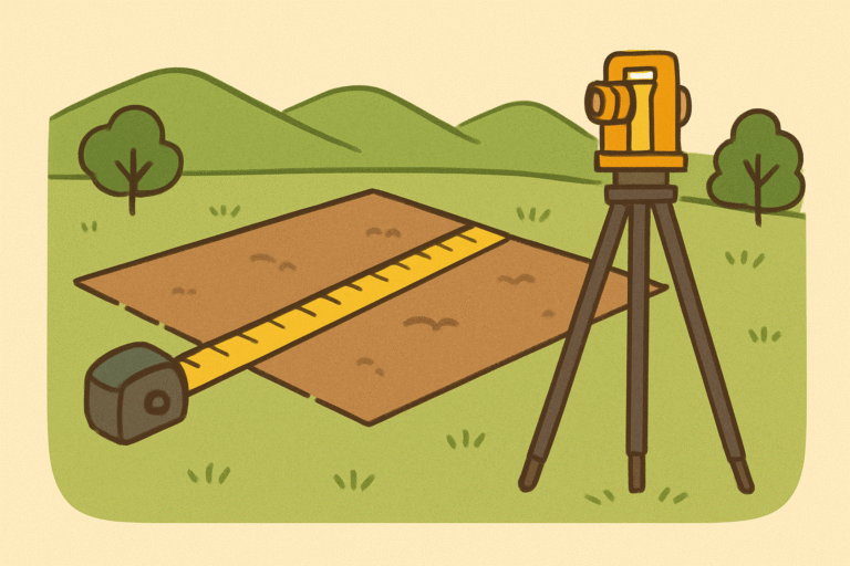
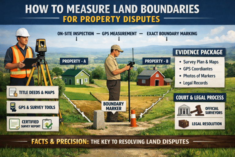
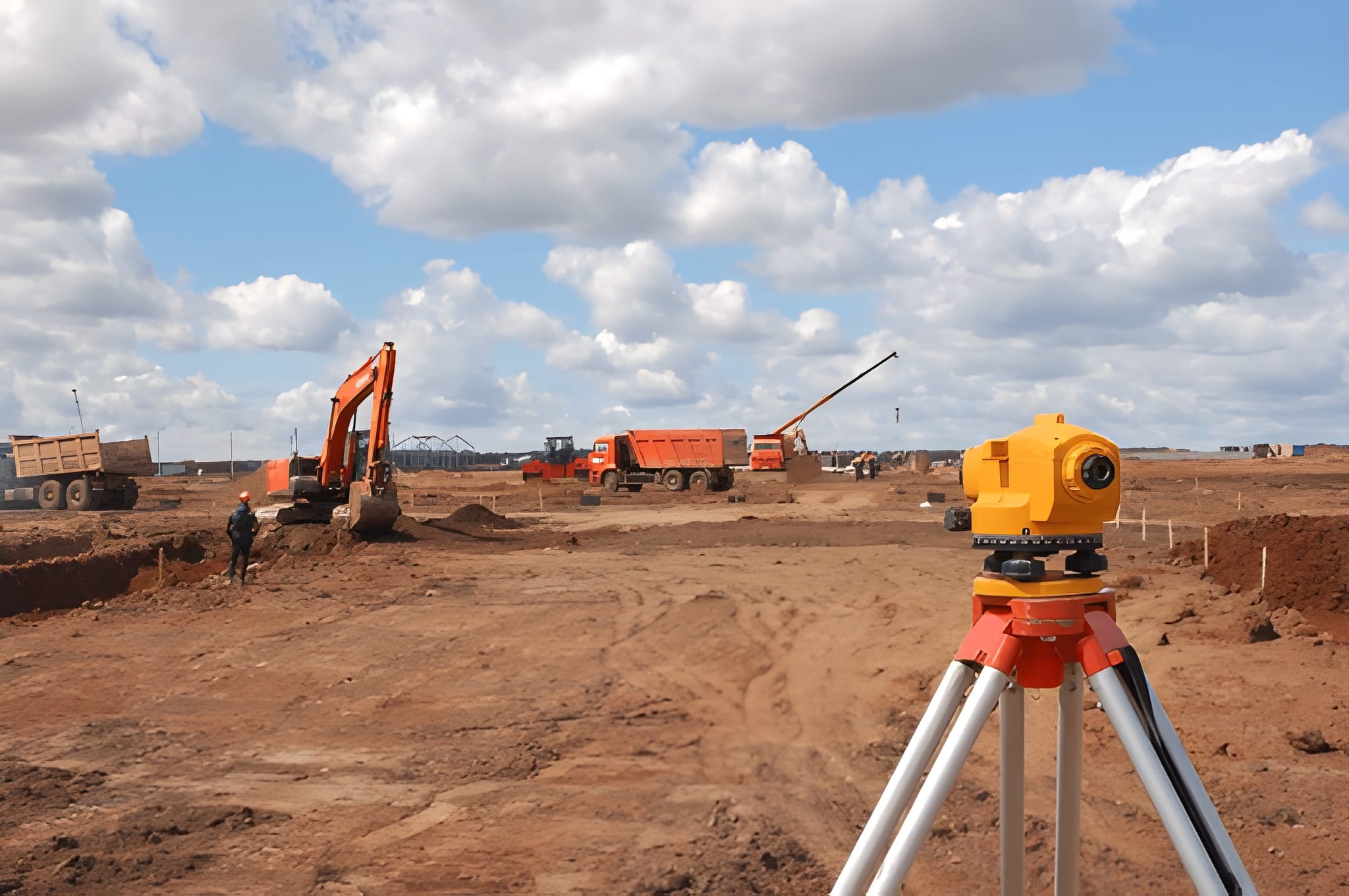
5. Surveying, Measuring & Mapping: Tools & Methods
Land measurement is not just about units and conversion. It’s also about how land is measured. Here are best practices, methods, and modern tools.
5.1 Traditional tools & methods
- Tape measure, chain (surveyor’s chain) or measuring wheel used for smaller plots.
- Surveyors historically used the “Gunter’s chain” (66 feet) as a unit of length in some jurisdictions.
- Stakes, rods and physical boundary markers: Important for ensuring accurate area measurement and for avoiding boundary disputes.
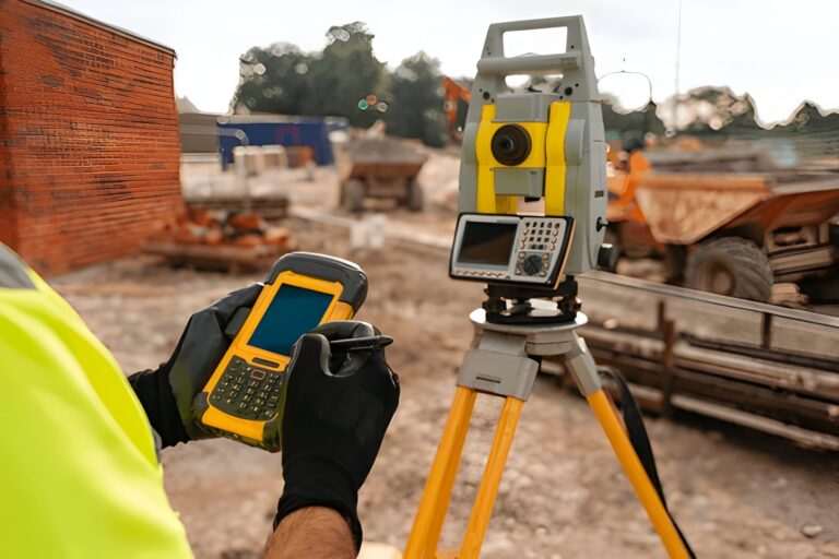
5.2 Digital and modern methods
- GPS / GNSS surveying: Surveyors use GNSS receivers to record exact coordinates of boundary points.
- Drone / Aerial photography: Captures land parcel imagery from above for mapping.
- GIS (Geographic Information System) / Cadastral mapping: Land record authorities often maintain digital maps of land parcels and boundaries.
- Mobile apps and satellite mapping: For rough estimation, many real-estate buyers use mobile apps to measure rectangular plots by inputting lengths or using remote measurement.
5.3 Best practice steps when measuring or checking land
- Identify the exact boundary – corners, adjacent property, any easements.
- Measure lengths – measure each side; verify given lengths in the deed.
- Calculate area – for rectangular/square plots: length × width. For irregular plots: break into triangles/rectangles or use coordinate method.
- Check unit definition – especially in local context: what does “marla” or “kanal” mean in this specific deal?
- Obtain survey-certificate or map – ideally the surveyed boundaries should match the legal deed.
- Use conversion tables – to ensure values match what you expect in square feet/metres/acres.
- Check for encroachments – there may be unrecorded portions or boundary illegally extended.
- Record results – document measurements, GPS coordinates, photographs, map copy.
6. Conversion Cheat-Sheet: Key Figures (Pakistan focus + international)
Here’s a helpful quick reference table for conversion values you’ll encounter. Use these for checks and understanding.
| Unit A | Equals in Unit B | Notes |
|---|---|---|
| 1 sq ft | ≈ 0.093 m² | Metric conversion |
| 1 sq yd | ≈ 0.836 m² | From Pakistan guide |
| 1 marla (common) | ~225 sq ft (~20.90 m²) | Region: some Punjab cities |
| 1 marla (alternate) | ~272.25 sq ft (~25.3 m²) | Region variation |
| 1 kanal | 20 marlas → approximately ~4,500 sq ft | Using 225 sq ft per marla example |
| 1 kanal (alt) | Using 272.25 sq ft per marla → ~5,444.8 sq ft | Based on alternative marla value |
| 1 acre (international) | 43,560 sq ft | Standard definition |
| 1 hectare | 10,000 m² ≈ 2.471 acres | Metric international unit |
| 1 Bega | 4 kanals → ~21,779.2 sq ft (~2008 m²) | According to one table for Pakistan |
| 1 Murabba / Square | 24 acres according to one definition | Very large unit, rural usage |
Important note: Because local definitions vary, always ask: “In this area, how many square feet does one marla represent?”
7. Common Uses & Practical Scenarios
Here we look at how these units and conversions apply in real-life scenarios, especially relevant to Pakistan, but helpful everywhere.
7.1 Residential plots in cities
- Urban plots may be quoted in marlas or kanals rather than in square feet.
- Example: A listing may say “5 marla plot” — but whether that marla is 225 sq ft or 272 sq ft matters for actual area.
- For example, using 225 sq ft: 5 marlas = 5 × 225 = 1,125 sq ft. According to one table.
- Using alternative (272.25 sq ft): 5 × 272.25 = 1,361.25 sq ft — big difference.
- So, if you’re comparing plots across different areas or developers, ensure consistent unit definition.
7.2 Agricultural land holdings
- Larger land is often quoted in kanals, acres, bega, murabba etc.
- For example, a small farm might be described as “4 kanals” or “1 acre” depending on region and the local vernacular.
- Farmers, buyers, contractors must convert to square metres or hectares to calculate irrigation needs, fertilizer amounts, cost per square metre, etc.
7.3 Real-estate transactions & due diligence
- When buying property, you’ll get a deed describing the land in units (marlas/kanals).
- Legal registration may use a standard unit as defined by the local revenue department, but the seller’s verbal explanation might differ.
- Using mapping and survey data helps you confirm the actual area corresponds to what is described.
7.4 Planning & construction
- If you’re building on a plot quoted as “10 marlas”, you need to know the exact area in square feet/metres to plan dimensions, setbacks, coverage area etc.
- Architects/engineers may require area in square metres for design calculations, hence conversion from local unit to metric is required.
7.5 Tax, zoning & record-keeping
- Local governments may levy taxes or stamp duties based on area. If the unit used is ambiguous, you may either under-pay (risking penalty) or over-pay.
- Maintaining digital records with GIS often requires area in a standard international unit (e.g., hectares or acres) so conversions help ensure compatibility.
8. Mistakes, Traps & What to Avoid
Here are recurring mistakes people make when dealing with land measurement — and how to avoid them.
8.1 Ignoring regional definitions
- As mentioned, a marla in one city may mean 225 sq ft; in another, 272.25 sq ft. If you assume one definition but the seller uses another, you’re in trouble.
- Always ask explicitly: “In this area (block/sector/town), one marla equals how many square feet?”
8.2 Over‐relying on verbal descriptions
- Someone might say “this plot is 5 marlas” but walk the land or measure: physically it might be smaller because the width or shape is non-standard.
- Always insist on the measurement of length & width and derive area rather than just trusting the unit.
8.3 Non-rectangular/irregular plot shapes
- A rectangular plot is easy: length × width. But many plots are L-shaped, triangular, or have cut-outs for roads.
- If you use a simple marla/kanal assumption without measuring the actual shape, you may misestimate.
8.4 Conversion errors
- Converting from local units to square metres/acres can introduce errors if you use wrong conversion factor.
- E.g., using 225 sq ft per marla when actually in that region 272.25 sq ft per marla — this leads to ~20% error.
- Always use a verified conversion table for that specific region.
8.5 Boundary disputes & encroachments
- Even if you know the unit and area, if your boundary marker is off, you may be encroaching or being encroached.
- Checking actual survey plan, verifying with neighbours, walking the boundary, marking stakes help avoid this.
8.6 Lack of updated survey data
- With urban expansion, old survey maps may not have accounted for new roads, utilities or subdivision of lands.
- Checking with local revenue/land record authority for latest map is wise.
9. Legal & Revenue Aspects
When dealing with land, measurement interacts with legal, revenue and regulatory mechanisms. Here are key points:
9.1 Deed/title description
- The legal deed will typically describe the land in certain units (e.g., “Plot No 123 measuring 10 marlas in Block-B”).
- It is wise to have the deed include both the local unit and the equivalent in square feet or square metres (for clarity).
- The deed should also refer to survey number, map number, and show boundaries.
9.2 Registration and stamp duty
- Many jurisdictions calculate stamp duty and registration fee based on area or value per unit area. Knowing exact area helps you verify correct duty.
- If area is mis-reported due to unit misunderstanding, you may pay more than you should or risk legal challenge.
9.3 Land record authorities & cadastral mapping
- In Pakistan, provincial authorities maintain land revenue records (e.g., patwar khana, tehsil records).
- With digitalisation (GIS, e-Arzi centres) more mapping and measurement are being standardised.
- Checking official map / cadastral boundary is advisable to confirm your land corresponds to record.
9.4 Encumbrances, servitudes & setbacks
- Land measurement alone is not enough: you must also check if part of the land is subject to right-of-way, utility easements, road widening, etc.
- These may reduce the usable area even if the gross measurement is correct.
9.5 Dispute resolution
- Many disputes arise because of misunderstanding of units or conversions. Being able to present correct measurement, backed by survey and correct unit definition, strengthens your legal position.
- Always keep surveying documents, map prints, conversion references, etc.
10. Learning Tips & Practical Checklist
Here’s a practical list you (or anyone dealing with land) should use as a checklist to ensure everything is covered:
- Ask for the unit definition in that area: “What does 1 marla equal here in square feet?”
- Check the physical dimensions: length and width of plot, maybe many sides if irregular.
- Calculate area manually: length × width (for rectangle) or use geometry for irregular shapes.
- Convert area into an international/regional standard you understand (e.g., square metres, acres) to compare.
- Compare what the deed says with your manual measurement. Are they consistent?
- Verify that the measuring instrument or method is correct (surveyor chain, GPS, etc).
- Confirm boundaries on ground: walk the corners, check neighbouring plots, look for markers.
- Check for any deductions: road access, setback requirements, utility lines.
- Retain measurement documentation – survey plan, map print, conversion sheet.
- Before payment or registration, verify area, unit, and unit definition to avoid surprises.
11. Bringing It All Together: A Sample Walk-through
Let’s go through a realistic example: You are in Lahore – you see a listing: “3 marla residential plot in block X”.
- First, you check what 1 marla means in this locality. Suppose you find: 1 marla = 225 sq ft.
- So 3 marlas = 3 × 225 = 675 sq ft. (≈ 62.71 m²) from the chart.
- You measure the plot: you find approximate length = 25 ft, width = 27 ft, which is 25 × 27 = 675 sq ft — so dimensions match.
- You confirm the boundary markers, check scheme plan to ensure plot corresponds.
- You convert 675 sq ft into square metres: 675 × 0.092903 = ~62.7 m² (good).
- You compare price per square foot with other plots in same block to ensure it’s reasonable.
- You also ask: is there any access road setback that will reduce usable area? Are the plot corners clear of utility encroachment?
- Once satisfied, you proceed with registration, using the same unit definition, and keeping records.
By doing this, you minimise risk of getting less land than you think, or paying too much.
12. Emerging Trends & Future of Land Measurement
As land markets evolve, measurement and mapping are undergoing some changes:
- More digital cadastral mapping and GIS-based land record keeping, reducing dependence on old chain/rod methods.
- Use of satellite imagery, drone mapping for verifying land parcel areas remotely. This is increasingly common. In Pakistan one source notes this shift.
- Standardisation of units and definitions: some authorities are pushing for consistent use of metric units (square metres, hectares) to reduce confusion.
- Mobile apps & online calculators: these let buyers and sellers convert units (e.g., marla ↔ square metre ↔ acres) quickly.
- More transparency: good practice will increasingly require the measurement in both local and international units, survey-certified boundaries etc.
13. Summary & Final Thoughts
Let’s summarise the key take-aways:
- Land measurement matters a lot — for legal clarity, fair value, planning and development.
- Know the difference between length and area, and use the right formulas.
- Be familiar with international/common units (acre, hectare, square metre) and local/regional units (marla, kanal, bega, murabba) especially in Pakistan.
- In Pakistan, unit definitions vary by region — one marla may equal 225 sq ft in one locality and 272.25 sq ft in another; always verify.
- Use conversion tables and double-check: for example, 1 marla (≈ 272.25 sq ft) × 20 = 1 kanal (~5,444.8 sq ft) in one definition. Scribd
- Always measure, check boundaries, verify survey maps, and compare the physical size with what the unit implies.
- Avoid traps: unit confusion, assumption of standard values, irregular shapes, encroachments, lack of documentation.
- Leverage modern tools: GPS, drones, GIS, mobile apps to ensure accuracy and transparency.
- Maintain documentation, ask the right questions, and make conversions part of your transaction review.
- When in doubt, consult a qualified surveyor, local land record office or legal professional specializing in property matters.