Tips for Accurate Land Measurement in South Asia
Accurate land measurement sits at the foundation of property ownership, agricultural productivity, real-estate development, and rural planning in South Asia. In Pakistan, India, and Bangladesh—regions marked by ancient land systems, diverse measurement units, dense populations, and intricate legal traditions—an error of a few feet can trigger long-lasting disputes, incorrect taxation, flawed irrigation layouts, or major construction setbacks. Land disputes are among the most common civil cases in these countries, and the majority of them originate from inaccurate measurement or poorly documented boundaries.
Achieving accuracy requires a combination of traditional knowledge, modern technology, legal understanding, and on-ground practical techniques adapted to South Asian terrain and land records. The following article provides an in-depth, end-to-end resource that covers everything from pre-survey preparation to legal verification, measurement tools, technology upgrades, common mistakes, and region-specific methods. It also addresses the gaps often left unaddressed by competitors—such as cross-border unit differences, cultural surveying barriers, land fragmentation, and rainfall-based distortions of soil boundaries.
1. Understand the Regional Land Measurement Systems
One of the biggest challenges in South Asia is the coexistence of dozens of land measurement units, many of which vary not only by country but also by state, district, and local tradition.
1.1 Pakistan
Common units:
- Kanal, Marla (varying between old and new definitions)
- Acre
- Khasra/Khatian numbers for land identification (Punjab & KPK)
- Jareeb, Karam, Square Karam in rural surveying
1.2 India
Measurement varies widely:
- Bigha, Biswa, Katha, Decimal (regional variations)
- Acre & Hectare for formal records
- Guntha and Ground in south India
1.3 Bangladesh
Common:
- Katha
- Bigha (Bangladeshi definition differs from Indian one)
- Decimal (widely used for formal records)
Tip:
Always verify which definition of the unit is used locally. For example, one Bigha in West Bengal ≠ one Bigha in Uttar Pradesh ≠ one Bigha in Bangladesh. A trained mapper always converts everything to square feet or square meters before calculating area to avoid mismatches.
2. Begin with Thorough Pre-Survey Preparation
Competitor articles often skip this essential stage. Accurate measurement depends more on good preparation than on fancy tools.
2.1 Gather All Existing Land Documents
- Land registry records
- Mutation records
- Khasra, Khatian, or Jamabandi documents
- Aks-Shajra or cadastral maps (old revenue maps)
- Previous survey maps, if available
- Any private boundary agreements among neighbors
Cross-checking these documents helps detect inconsistencies before measurement begins.
2.2 Interview the Neighboring Landholders
A unique South Asian challenge is the informal nature of boundaries. Many rural land parcels depend on:
- verbal agreements,
- traditional markers (trees, stones),
- fences erected by previous generations,
- irrigation channels, and
- historical walking paths.
By speaking to neighboring farmers and landowners, you avoid boundary disputes during or after measurement.
2.3 Visit the Site in Advance
Pre-inspection helps identify:
- uneven terrain
- encroachments
- waterlogging areas
- demolished fences
- vegetation that hides boundary points
This saves time on the actual measurement day.
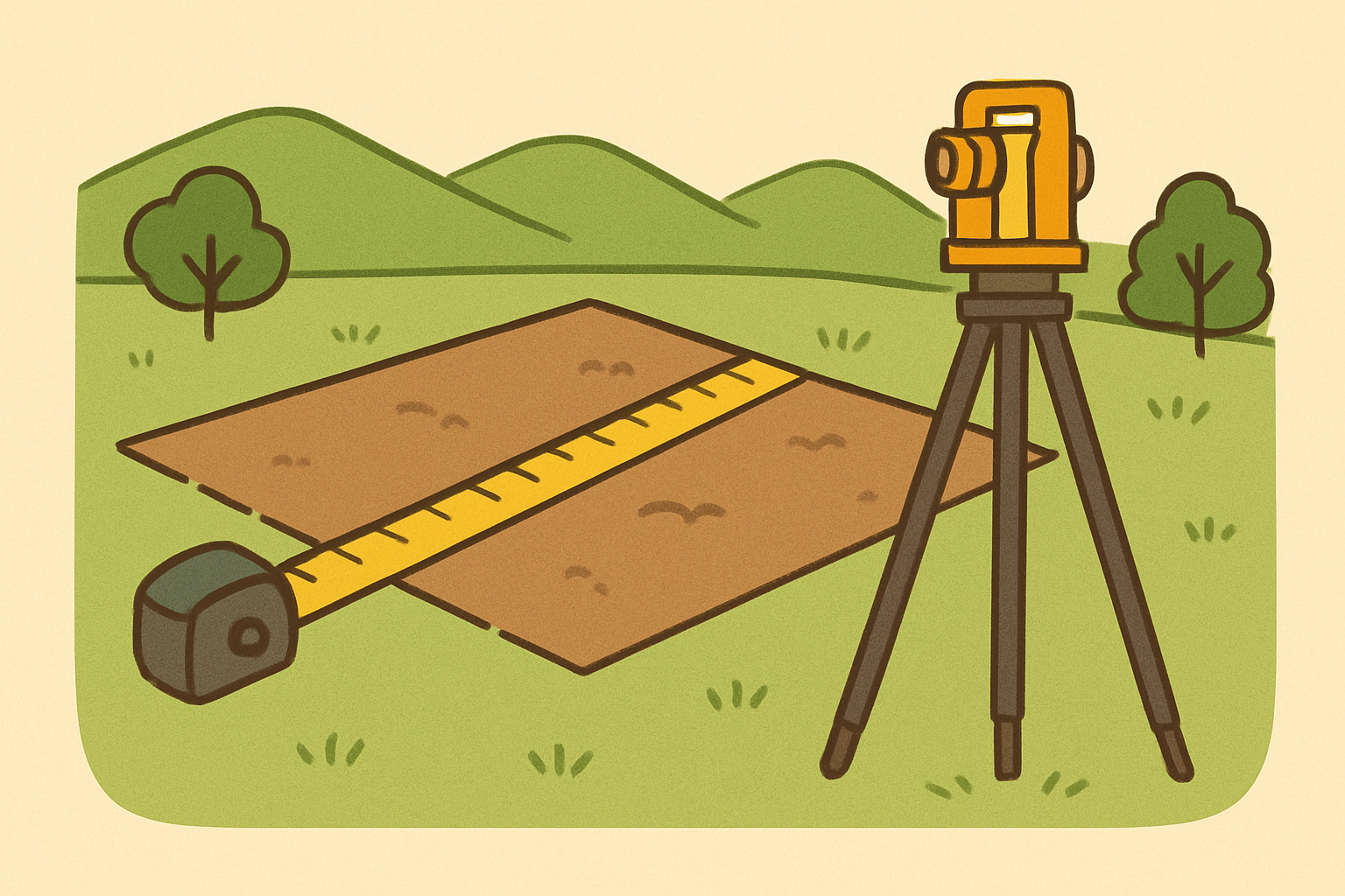
3. Use the Correct Measurement Tools for the Terrain
Measurement accuracy varies depending on tools, but the choice of tool must match the land’s condition, not just your budget.
3.1 Measuring Tape & Chain Survey
Still common for small plots (especially in Pakistan and Bangladesh).
- Ideal for flat land
- Affordable
- Easy for farmers to understand
Limitations:
Chain expansion in summer, contraction in winter, sagging on slopes, and vegetation obstruction can cause errors.
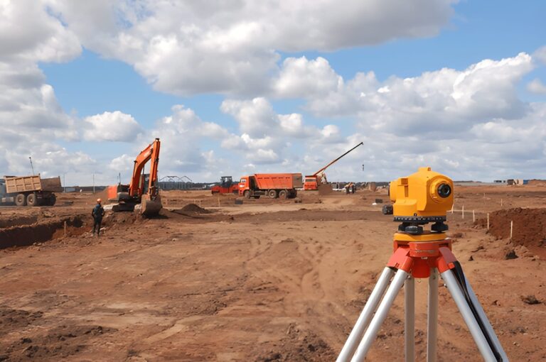
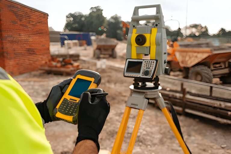
3.2 Total Station
A professional surveying instrument that provides:
- high precision
- angle measurement
- distance calculation
- elevation mapping
Best for urban plots, housing societies, and construction layouts.
3.3 GPS & GNSS Devices
Modern handheld GNSS devices give:
- sub-meter accuracy (basic models)
- centimeter-level accuracy (RTK GNSS)
South Asia’s terrain and dense atmosphere sometimes interfere with signals, so surveyors often cross-check with ground measurements.
3.4 Mobile Apps
Useful for rough estimates, not professional surveys.
They perform well for:
- preliminary measurements
- agricultural planning
- approximate boundary mapping
But they should never replace professional tools when legal accuracy is required.
3.5 Drone Surveys (ASEAN-style modernization gap in local content)
Many competitors don’t cover drone surveying.
Drones offer:
- highly detailed orthomosaic maps
- contour mapping
- accurate area measurement for large farmlands
- safer access to flooded or forested lands
Modern farm cooperatives in Punjab (India & Pakistan) and northern Bangladesh are increasingly adopting drones for agricultural layout planning.
4. Mark and Establish Boundary Points Clearly
Boundary points are the backbone of accurate measurement. Without them, even the best tools cannot deliver correct results.
4.1 Physical Markers
Common markers include:
- concrete pillars
- iron rods
- stone markers
- treated wooden posts
Markers should be placed at every turning point of the boundary.
4.2 Georeferenced Boundary Points
Use GPS or GNSS to record:
- latitude
- longitude
- elevation
This helps maintain boundary integrity even if physical markers are removed or destroyed.
4.3 Traditional Boundary Cues
In many South Asian villages, boundaries are historically marked by:
- old banyan or neem trees
- canals
- bunds
- embankments
- large stones
Although these cannot replace official markers, they help confirm local consistency during re-measurement.
5. Follow the Proper Measurement Techniques
5.1 Field Traversing Method
Used in:
- urban development
- housing societies
- large farmlands
This method establishes a closed loop of boundary points to minimize errors.
5.2 Triangulation Method
Ideal for:
- hilly terrains
- uneven agricultural lands
Triangulation creates a network of triangles that mathematically strengthen the accuracy of measurements.
5.3 Plane Table Survey
Although outdated in some regions, still used in remote areas where electronic tools are impractical.
5.4 Offset Measurements
Useful for measuring land obstructed by:
- ponds
- trees
- buildings
- irrigation channels
Surveyors measure offsets to calculate boundaries around obstacles accurately.
6. Check for Seasonal Distortions (Competitor gap)
South Asia experiences floods, monsoons, and soil movement. These can distort land boundaries temporarily.
6.1 Monsoon Effects
- Soil expands
- Boundary bunds collapse
- Water turns straight edges into curves
Measurement taken immediately after the monsoon is often inaccurate.
6.2 Winter Shrinkage
Dry soil contracts, causing slight shifts in boundary markers.
6.3 Floodplain Areas
Bangladesh and parts of India/Pakistan have moving riverbanks. Always confirm with:
- satellite images
- government river maps
- latest cadastral updates
7. Convert All Measurements to Standard Units
The safest approach is to always convert to square meters or square feet.
Reasons:
- prevents confusion
- standardizes calculations
- allows comparison across regions
- ensures legal compliance
Never finalize area calculations in Kanal/Marla, Bigha, or Katha without converting them to standard units first.
8. Use Multi-Method Verification
Accuracy increases dramatically when multiple tools and techniques cross-verify results.
Recommended combination:
- GPS/GNSS for rough mapping
- Measuring tape or total station for boundary lines
- Drone for aerial verification
- Document comparison for legal accuracy
Professional surveyors always repeat measurements at least twice.
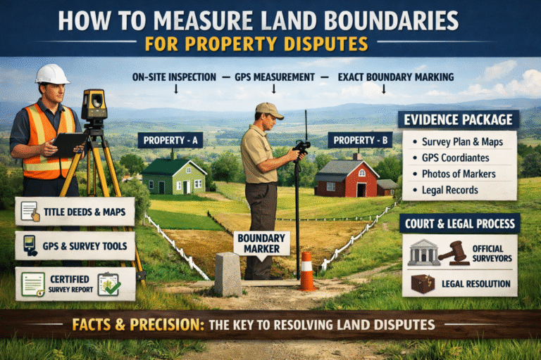
9. Understand the Legal Framework
Each country has its own land laws. While the specifics vary, the principles remain similar.
9.1 Pakistan
Important resources include:
- Board of Revenue records
- Fard Malkiat
- Khasra numbers
- Aks Shajra maps
Accurate measurement is needed for:
- mutation
- registry transfer
- housing society approvals
9.2 India
Land measurement ties heavily with:
- Record of Rights (RoR)
- Khasra/Khatauni
- Cadastral mapping
States have digitized land records (e.g., Bhulekh, Jamabandi portals).
9.3 Bangladesh
Uses:
- Namjari
- Khatian (CS, SA, RS)
- DCR (Deed of Conveyance Registration)
Verification with RS maps is essential.
Legal Tip:
Always attach a certified survey map—preferably georeferenced—to property documents to avoid future disputes.
10. Avoid the Most Common Mistakes in South Asian Land Measurement
Competitors rarely cover these:
10.1 Human Errors
- Misreading tape due to sag or slope
- Incorrect angle measurement
- Starting measurement from incorrect benchmarks
10.2 Traditional Guess-Measurement
Some farmers “estimate” land by walking, which leads to large errors.
10.3 Measuring Only One Side of Irregular Shapes
Irregular lands need diagonal measurements, not just perimeter.
10.4 Relying on Old Fences
Fences often shift over time due to cattle, floods, or new construction.
10.5 Ignoring Magnetic Declination
When using a compass in hilly areas, ignoring magnetic variation introduces angle errors.
11. Integrate Technology With Traditional Knowledge
South Asia’s unique combination of modern development and traditional land practices requires blending both methods.
11.1 Combine Satellite Imagery with Local Boundary Memory
Satellite mapping offers macro accuracy, while villagers can confirm micro-boundaries.
11.2 Using Drones for Agricultural Optimization
Drone-based mapping is extremely useful for:
- field leveling
- irrigation channel planning
- drainage mapping
- spotting encroachments
11.3 RTK GNSS for Legal Surveys
Used in:
- real estate
- construction
- farmland consolidation
- municipal projects
12. Maintain Detailed Survey Records
After measurement:
- mark coordinates
- store maps in digital and printed form
- upload maps to government portals if applicable
- share copies with all stakeholders
- record the date and tool used
This ensures consistency for future re-measurement.
13. Work With Certified Surveyors for High-Value Land
For urban land, agricultural estates, or land involved in legal disputes, always involve:
- licensed surveyors
- revenue officials
- cadastral mapping professionals
Although farmers or small landowners can do basic measurement, legal accuracy needs certified experts.
14. Regularly Re-Measure High-Risk Lands
Re-measurement is critical for:
- lands near rivers
- lands adjoining busy markets
- areas prone to encroachment
- fast-developing urban zones
- land preparing for sale or division
This ensures that boundaries remain intact and legally defensible.
Conclusion
Accurate land measurement in South Asia requires far more than a tape measure or a quick GPS reading. The region’s complex measurement units, shifting terrains, seasonal impacts, legal systems, traditional boundary markers, and diverse surveying technologies demand a holistic approach. Mastery comes from combining traditional knowledge with modern tools—total stations, drones, satellite imagery, and GNSS—while adhering to legal standards and cross-checking every detail.
Whether the land is agricultural, urban, residential, floodplain, or hilly, following the techniques outlined above ensures precision, protects ownership rights, prevents disputes, and supports smart agricultural or construction planning. With the rapid modernization of land mapping across Pakistan, India, and Bangladesh, investing in accurate measurement is no longer optional—it’s essential for economic security, legal safety, and sustainable development.
FAQs About Land Measurement in South Asia
1. Why is accurate land measurement important in Pakistan, India, and Bangladesh?
Accurate measurement prevents boundary disputes, ensures fair taxation, supports proper construction planning, and protects legal ownership rights.
2. Which land measurement units are commonly used in South Asia?
Units vary by region—Kanal, Marla, Acre, Bigha, Katha, and Decimal are the most common, but their definitions differ between provinces and countries.
3. What is the most reliable method for measuring land?
A combination of Total Station, RTK GNSS, and drone mapping provides the highest accuracy. Traditional tape/chain measurements work for small, flat plots.
4. Why do Bigha and Katha units differ from place to place?
These are traditional units inherited from local revenue systems. Each region historically defined them differently, so conversions are not standardized.
5. Can mobile apps accurately measure land?
Mobile apps are useful for rough estimates but should not be used for legal, construction, or registry purposes due to limited accuracy.
6. How often should land be re-measured?
Re-measurement is recommended for lands near rivers, areas with rapid development, or plots where encroachment risk is high.
7. What documents should I collect before measuring land?
Gather Khasra/Khatauni/Jamabandi records, registry documents, old maps (Aks-Shajra), mutation papers, and any previous survey maps.
8. Do seasonal changes affect land boundaries?
Yes. Monsoon floods, soil shrinkage, and river erosion can distort boundaries, especially in rural or floodplain regions.
9. Can drone surveys be used for farmland?
Yes. Drones create detailed aerial maps, making them ideal for agricultural layout planning, irrigation design, and large land calculations.
10. Should I hire a certified surveyor?
For high-value, disputed, or urban land, hiring a licensed surveyor ensures legal accuracy and avoids future boundary conflicts.