How to Measure Land Boundaries for Property Disputes
Land boundary disputes are among the most common and emotionally charged property conflicts worldwide. Whether the land is urban, rural, agricultural, or commercial, disagreements over “where my land ends and yours begins” can escalate quickly sometimes dragging on for years and costing far more than the land itself.
As a land measurement professional, I’ve seen disputes arise not because people are dishonest, but because boundaries are misunderstood, poorly documented, inaccurately measured, or illegally altered over time. Old records, broken boundary markers, informal measurements, and unverified maps are the root causes in most cases.
This guide explains how land boundaries should be measured correctly for property disputes, covering:
- Legal and technical foundations
- Ground measurement methods
- Survey tools and technologies
- Satellite and GPS-based measurements
- Role of licensed surveyors
- Evidence required in court
- Common mistakes to avoid
- Step-by-step dispute-ready process
This is not theory. This is how boundary measurement actually works in real disputes.
Understanding What a Land Boundary Legally Means
Before measuring land, it’s critical to understand one thing:
A land boundary is a legal concept first, and a physical measurement second.
A boundary is defined by official records, not by fences, walls, trees, or what neighbors believe.
Legal Sources That Define Boundaries
In most countries, legal land boundaries are established by:
- Title deeds
- Registry or cadastral maps
- Mutation records
- Survey plans
- Subdivision records
- Government demarcation documents
Physical features only matter if they are officially recorded.
Step 1: Collect All Legal Documents Before Measuring
Never start measuring land for a dispute without collecting documents first. Measurement without legal context is meaningless.
Essential Documents to Gather
- Title Deed / Sale Deed
- Confirms ownership
- Mentions plot number, size, and boundaries
- Cadastral or Registry Map
- Official government map showing plot outlines
- Survey Plan (If Available)
- Most reliable reference document
- Mutation or Transfer Records
- Confirms current registered status
- Old Demarcation Records
- Very important in long-standing disputes
If documents conflict, older original survey records usually hold higher authority.
Step 2: Identify Boundary Descriptions in Records
Most land records describe boundaries in one of three ways:
1. Fixed Measurements (Metes and Bounds)
Example:
- North: 100 feet
- South: 100 feet
- East: 50 feet
- West: 50 feet
This is the clearest and easiest type to measure.
2. Adjoining Owners or Landmarks
Example:
- North: Property of Ahmed
- South: Public road
This method is common but problematic if neighbors changed or roads shifted.
3. Plot Number-Based Boundaries
Common in planned societies and urban areas, relying heavily on official maps.
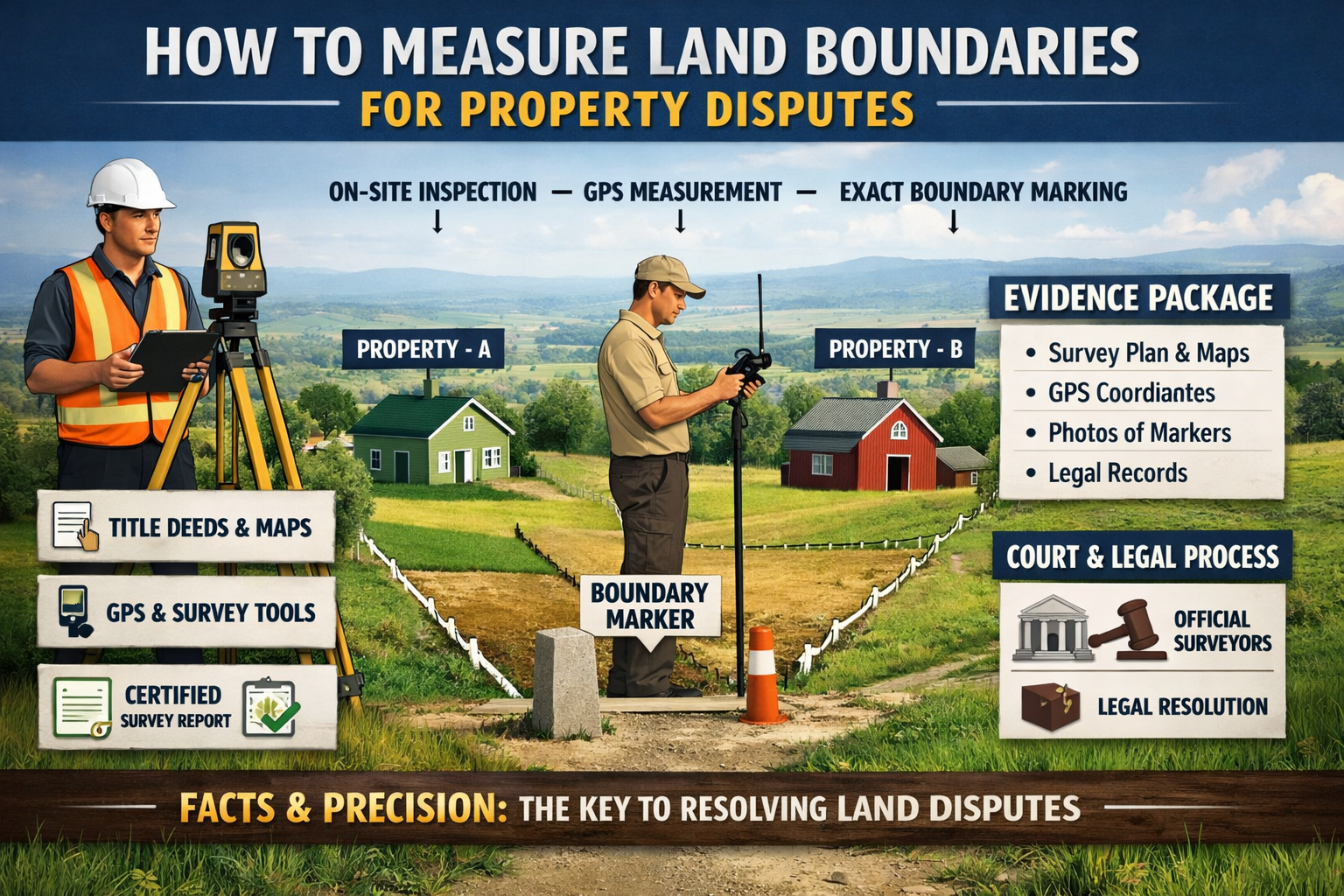
Step 3: Ground Reconnaissance (On-Site Inspection)
Before using tools, professionals conduct a physical inspection of the land.
What Is Checked On-Site
- Existing boundary markers or stones
- Old pillars or pegs
- Fences or walls
- Roads, drains, canals
- Natural markers mentioned in records
⚠️ Important:
Fences and walls do not automatically define legal boundaries unless they match official records.
Step 4: Traditional Ground Measurement Methods
Traditional methods are still widely used and legally accepted when done correctly.
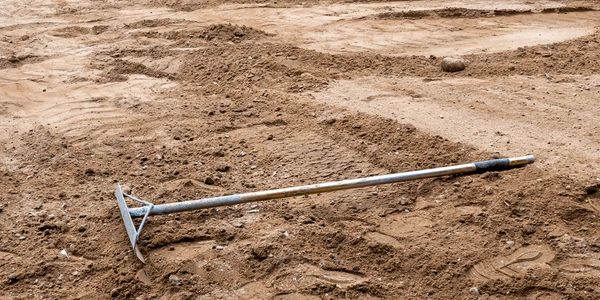
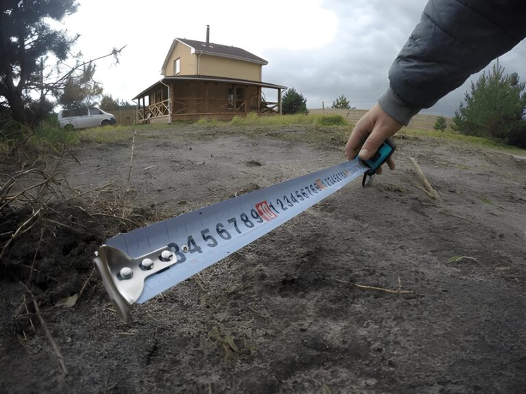
1. Chain or Tape Measurement
Used for:
- Small plots
- Simple rectangular lands
Pros:
- Low cost
- Easy to perform
Cons:
- Human error
- Not reliable for disputes alone
2. Compass Surveying
Used to:
- Determine angles and directions
Limitations:
- Magnetic interference
- Less precise than modern tools
These methods are acceptable only when supported by official records.
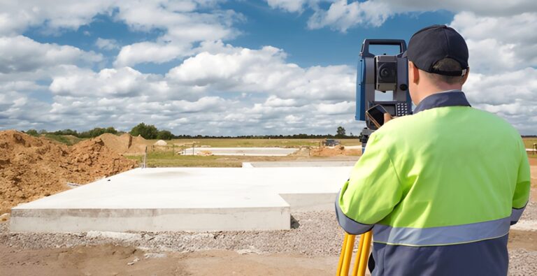
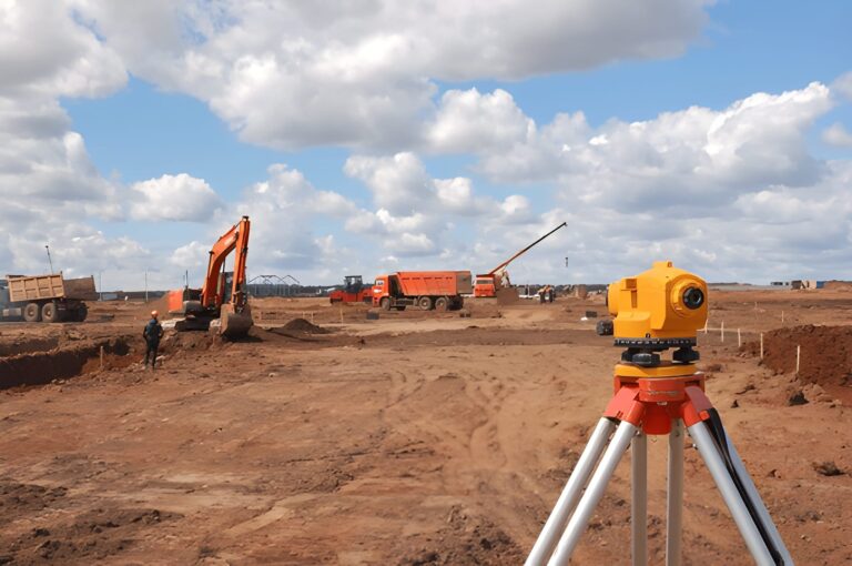
Step 5: Professional Land Surveying (Most Critical Step)
For any serious property dispute, a licensed land surveyor is essential.
What a Licensed Surveyor Does
- Studies legal records
- Uses certified equipment
- Re-establishes original boundary points
- Produces a legally admissible survey plan
Tools Used by Professional Surveyors
- Total Station
- Differential GPS (DGPS)
- Theodolite
- Auto levels
Surveyors do not “guess” boundaries—they reconstruct them based on legal and mathematical principles.
Step 6: GPS and Satellite-Based Land Measurement
Modern disputes increasingly involve GPS and satellite measurements, especially where records are unclear.
How GPS Measurement Works
- Uses satellite signals to determine precise coordinates
- Boundaries are mapped using latitude and longitude
Accuracy Levels
| Method | Accuracy |
|---|---|
| Mobile apps | ±3–10 meters |
| Handheld GPS | ±1–3 meters |
| DGPS | ±1–5 centimeters |
For disputes, only high-accuracy GPS or DGPS is acceptable.
Step 7: Satellite Imagery as Supporting Evidence
Satellite images do not define boundaries legally, but they are powerful supporting tools.
Where Satellite Data Helps
- Showing historical land use
- Detecting encroachments
- Verifying roads, canals, and plots
- Comparing past and present layouts
Courts often accept satellite imagery as corroborative evidence, not primary proof.
Step 8: Boundary Re-Establishment (Demarcation)
This is the most sensitive phase.
What Demarcation Means
Demarcation is the process of physically marking legal boundaries on the ground using:
- Concrete pillars
- Iron pegs
- Boundary stones
It must be done:
- By authorized officials or licensed surveyors
- In presence of parties (preferably)
- Based strictly on official records
Unauthorized demarcation has no legal value.
Step 9: Preparing Evidence for Property Disputes
For disputes, measurement alone is not enough. Documentation is everything.
Evidence Package Should Include
- Certified survey report
- Measurement methodology
- Coordinates and maps
- Photos of demarcation
- Copies of legal records
- Surveyor’s license details
This package is what courts rely on—not verbal claims.
Step 10: Role of Courts and Revenue Authorities
In many regions, land disputes are resolved through:
- Civil courts
- Revenue courts
- Land tribunals
Courts often order:
- Fresh demarcation
- Joint surveys
- Government surveyor reports
Private measurements without authority rarely settle disputes permanently.
Common Mistakes That Destroy Boundary Claims
- Measuring without legal records
- Relying on mobile apps alone
- Accepting fence lines as boundaries
- Using unlicensed surveyors
- Ignoring old survey maps
- Altering markers without permission
One wrong step can invalidate your entire claim.
Urban vs Rural Boundary Measurement Differences
Urban Areas
- Grid-based plots
- Map-centric
- Higher accuracy required
Rural Areas
- Natural landmarks
- Older records
- Greater reliance on re-establishment
Approach must match the land type.
Cost of Proper Boundary Measurement
Costs vary by:
- Land size
- Location
- Complexity
- Technology used
However, professional measurement is always cheaper than prolonged litigation.
When to Measure Land for Dispute Prevention
Best time to measure:
- Before buying property
- Before construction
- Before fencing
- Before selling
Prevention is always easier than resolution.
Final Expert Advice
As a land measurement expert, my advice is simple:
Never argue boundaries with opinions argue with evidence.
Correct land boundary measurement is a legal, technical, and procedural process, not a casual activity. When done properly, it can resolve disputes decisively. When done poorly, it can worsen them.
If a boundary matters enough to fight over, it matters enough to measure correctly, legally, and professionally.